On Saturday 11th March 2017, we held a LiDAR Workshop for the Spa Ponds Heritage Project. Phil’s account of the day is below:
Welcome to the third in our series of accounts of the activities taking place as part of the Heritage Lottery Fund supported Spa Ponds Heritage Project. The day-long training session was led by David Astbury of MBArchaeology, who treated participants to a presentation that introduced us to the use of Light Detection and Ranging (LiDAR) for local history research. David is a PhD researcher at the University of Newcastle.

Part 1
The first part of the morning consisted of a comprehensive explanation of what LiDAR is and how data is obtained, processed, visualised, interpreted and finally transcribed.

Light Detection and Ranging (LiDAR) is an airborne mapping technique, which uses a laser to measure the distance between the aircraft and the ground. Up to 100,000 measurements per second are made of the ground, allowing highly detailed terrain models to be generated at spatial resolutions of between 25cm and 2 metres.
David’s introduction was similar to that available from: https://www.youtube.com/watch?v=eBUCGxZq_xg which is a good primer for those who could not attend the workshop.
David explained how the data is based on the number of ‘returns’ from the laser pulses generated by the plane. LiDAR cannot pass through objects such as leaves and tree branches but will pass between such obstacles until it hits the ground.
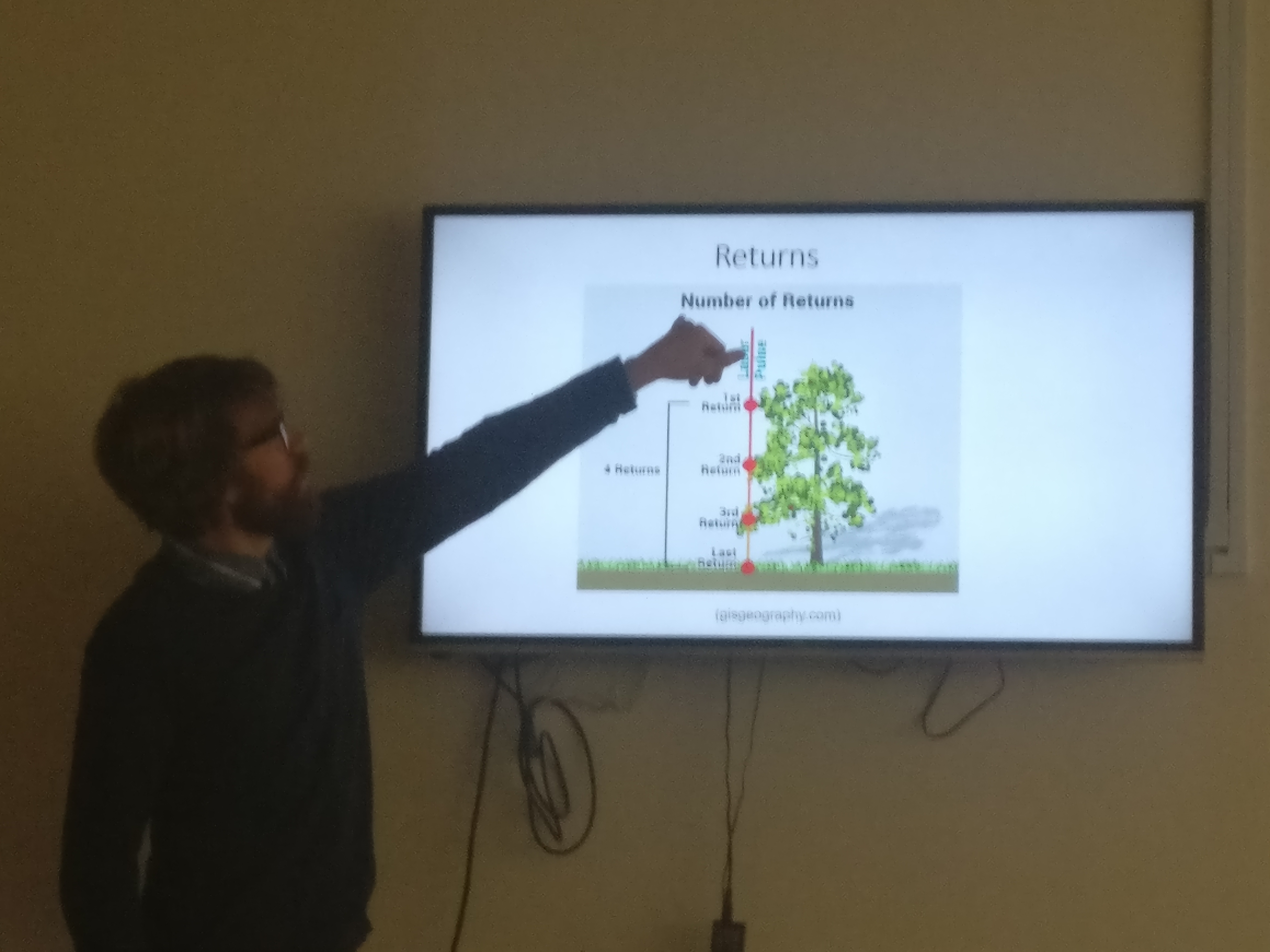
Examples were given where 4 ‘returns’ would indicate 3 levels of branches with the final return being the ground, thus mapping the height of the tree. This explanation was particularly relevant to our Spa Ponds site being largely tree covered.
LiDAR data is available to the public due to nationwide surveys undertaken by the Environmental Agency to indicate flood risk areas. The data does need quite complicated software to interpret the data but again this is freely available from: http://environment.data.gov.uk/ds/survey/
David continued by explaining, step-by-step, the types of data provided by LiDAR. Two main models use in this field are: the Digital Surface Model (DSM) and the Digital Terrain Model (DTM). DTM has the ability to ‘strip away’ the data collected from tree coverage to reveal the data reflected from the ground only.

David continued by explaining how data is processed using GIS. The OS provide a helpful explanation of their own at:
https://www.ordnancesurvey.co.uk/support/understanding-gis/what-is-gis-data.html
Simply put, a Geographic Information System (GIS) is a system designed to capture, store, manipulate, analyse, manage, and present spatial or geographic data.
Various levels of data can be placed on top of each other such as LiDAR, maps or aerial photographs. We were shown several examples of GIS output for the Spa Pond area and David explained how three different approaches can give different results. These were Hillshade Aspects, Composite Bands and Slope Data.
Hillshade data was particularly interesting as the software allows the computer to model how the image would adjust when viewed with sunlight approaching the site from several compass points. Composite Bands added colour to the images with each specific colour representing a geographical feature such as flat ground or slope.

David then moved to the Visualisation stage of the interpretation of data, where several sources of information such as LiDAR, Ordinance Survey maps, Google Earth and other aerial photographs, as well as images and information supplied by the Sites and Monument Records (SMR) or the National Monuments Record (NMR) work synergistically together to provide an understanding of the site. In addition to the SMR and NMR we now also have the Historic Environment Records (HER).

David ended the first session with an excellent demonstration of the 3D modelling capability of the software by ‘flying’ us through the Spa Pond site and providing remarkable views of the site from several elevations.
Part 2
An important message in this session was to never rely on LiDAR on its own. LiDAR should be used alongside a variety of sources such as aerial photographs, current and ancient maps, Google Earth images, and SMR/NMR/HER information.

LiDAR will only give data from objects above ground. Data from below ground can be obtained by using Geophysics technology. David recounted examples of wrongly interpreting LiDAR data where excited researchers found Stone Circles that turned out to be Mineral Railway lines and where old Roman roads turned out to be gas pipelines! Unfortunately, areas of ground that have been extensively ploughed in modern times will offer little to LiDAR.

Lunch
After lunch David introduced a practical session where he supplied a variety of LiDAR images of the Spa Ponds area. The group split into small working parties to analyse the different images looking for and sharing points of interest. This session was an ideal opportunity to use the skill absorbed during the morning session.

The day was brought to a close with a vote of thanks to David Astbury and MBArchaeology who had prepared and presented an excellent workshop where a particularly complicated scientific process had been presented succesfully to a group of LiDAR beginners. Thanks were also given to members who had enhanced the day by way of providing refreshments and taking photographs.