On Saturday 17th June 2017 Stephen Walker delivered the Reading the Landscape Workshop for the Spa Ponds Heritage Project. Shlomo and Josh’s account of the day is below:
To help us think at a ‘landscape scale’ Stephen began by introducing us to the various ways that geomorphic processes influence creation of landforms and shape the planet earth. A representation of the landscape and geology is seen in the geological memoirs and we were shown a diagram of the geology of our area (Source: Edwards, W.N, ‘The geology of the country around Ollerton’, (HMSO, 1967) – see page 2 (Plate 1) of http://pubs.bgs.ac.uk/publications.html?pubID=B01568). This demonstrated how the beds of rock slope from west to east (called the ‘dip’ of the rocks) and showed the different layers of rock that form the valleys and hills around Spa Ponds. The Maun follows the dip of the rocks as it makes its way from west to east towards the Trent.


Next he introduced us to the rocks which underlie our part of the Maun valley. Terminology has changed over the years, so we agreed to use the traditional names applied to the rock layers. The Bunter Sandstone (also known as ‘Nottingham Castle Sandstone’) is youngest and nearer the surface, whereas Lower Mottled Sandstone (also known as ‘Lenton Sandstone’) is older and lower down. It is also softer and more easily eroded. We were also introduced to ‘Marl’ which is clay rock rich in lime. Importantly, Marl does not allow water to pass through. This means that any water in the sandstone that is between two layers of Marl will be trapped unless it finds a way out.
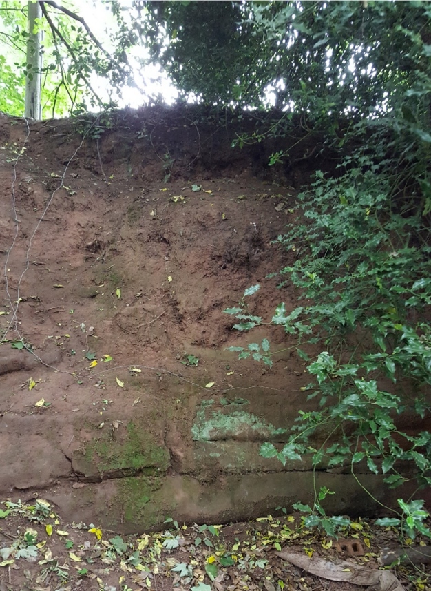
Stephen showed us photographs he took in Mansfield of different geological layers:


This portion of the presentation was followed by a group discussion about influences on the landscape at Spa Ponds. Such influences included:
- Slopes on either side directing water towards the ponds as well as causing erosion
- Different geological layers of sandstones and marl possibly giving rise to the underground springs
- Changes to the landscape resulting from human activity, e.g. mining and subsidence (and mine water changing water table level)
- Construction of ponds (ancient and modern)
- Changing path of river for flood dykes (in both 13th and 19th centuries)
- Planting of trees (including pine)
- Run-off from nearby farms
- Localised flooding (flash floods)
- Animals using the River Maun (including dogs causing erosion when/exiting the water over damp river banks)
Arising from the discussion, Stephen explained how water flowed over the surface and sometimes through the rocks and soil. The interrelationship between the sandstone layers which are permeable (allow water through) and the scattered marl beds which are impermeable (don’t allow water through) is the likely cause of the springs which feed Spa Ponds.

Discussions moved on to include ideas for mapping of springs and ponds in the vicinity of Spa Ponds to help us understand the setting. Also discussed was measuring the time it takes between weather events, e.g. rainfall, and observable changes to the water flow between the ponds and/or the water level in the ponds/river.

Next Stephen treated us to an explanation of the impacts of the Anglian and Devensian Ice Ages in this area. He noted how one effect of glaciation was that the River Trent was diverted because of melting glaciers. This is relevant to Spa Ponds as the River Maun flows towards the Trent. It is safe to assume that the area we know of as Spa Ponds would have been completly covered by ice during the earlier Anglian Ice Age because Anglian deposits are found nearby. However, this area would have been on the edge of the ice sheets during the Devensian Ice Age. The valley that includes Spa Ponds could have been formed in the interglacial (warm) period between the Anglian and Devensian Ice Ages.
The Anglian and Devensian periods are the geological terms for what archaeologists call the stone age. It is likely that there were people in this landscape. At Farndon (in the Trent Valley) the ‘Ice Age Journeys’ project has been investigating stone age hunting camps, so it is possible that the hunters also passed along the Maun valley.

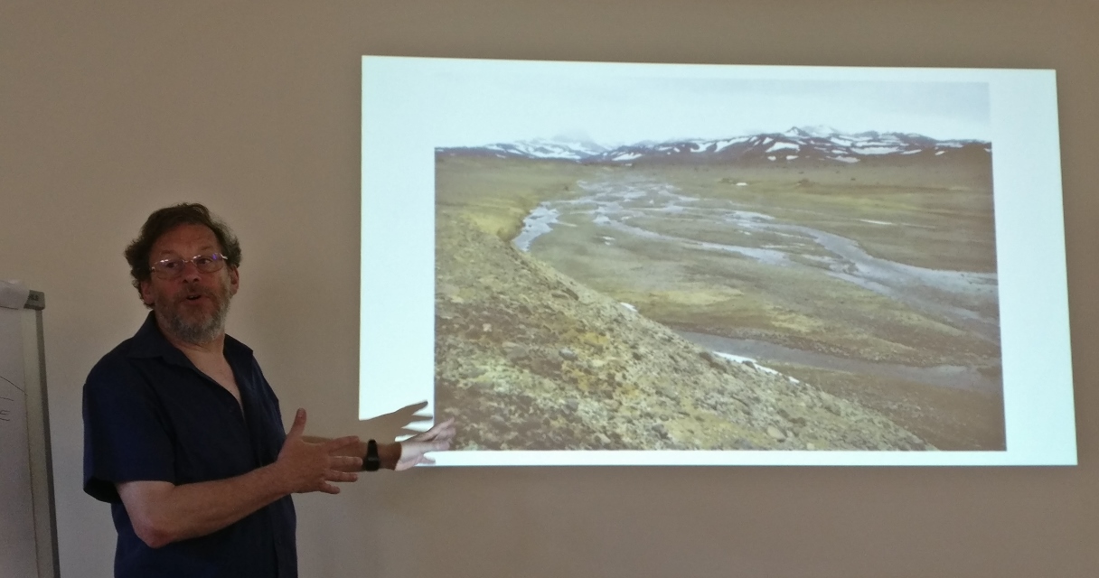
Stephen introduced us to the term ‘periglacial’ (meaning ‘on the margins of a glacier’), explaining how Spa Ponds would have been part of an environment that was on the edge of a glacial environment, meaning that water on the land would freeze and then thaw repeatedly to cause weathering. In summer, meltwater would flow across the frozen subsoil (permafrost) just as it does in Siberia today. Seasonal streams charged with meltwater flowing over the frozen ground could have created valleys which now have no surface streams, (and are known as ‘dry’ valleys). This proposition is supported by the LiDAR evidence of ‘side valleys’ and what Stephen described as the Dendritic drainage pattern (see photo above).
Alternatively, Stephen explained how limestone is eroded into caves by underground water and how in some areas along the Maun such caves have collapsed to create valleys.
Stephen then offered us a series of questions to help us focus on what we know and what we might wish to know about the Spa Ponds landscape. He also posed the following three important questions to help us decide our next steps:
- What are our research priorities?
- What help and resources are required?
- What are the management implications?
Some ideas arising in response to these questions included:
- Consider what we might learn from the Ice Age Journeys project
- Explore the implications of artesian basin for water pressure and the relevance to the underground springs at Spa Ponds
- Contact Dr Andy Howard, who is an expert in periglacial research, to discuss periglacial influences on Spa Ponds
- Find out more about water table level monitoring held by the Environment Agency
- Undertake a longitudinal (long section) study of Spa Ponds to determine the height of the ponds
- Focus core sampling efforts on Pond 0 (Fern Gulley) and Pond 1
- Measure the water flow and compare results with those recorded by Tony Davison (in 1995)
- Find out more about historic landfilling in and around Spa Ponds
- Map and analyse nearby springs to determine if they are at the same level as spa Ponds, as this could indicate that the springs are related to the underlying strata, in particular the clay partings
- Locate nearest brick pits to help answer the question about where the clay (used to line the ponds) might have originated
- Research local mining history as it relates to mine water, subsidence, etc., including checking with the Coal Board to see if they have records of pumping / water table (e.g. around Clipstone Colliery) and borehole data from test holes and shafts sunk (to help identify sandstone and marl layers in and around Spa Ponds)